Effortlessly shipping cars, motorcycles, trucks or any vehicle to/from any location in Connecticut
Connecticut Vehicle Shipping & Heavy Haul Transport Experts
Ship a Car, Inc. delivers superior shipping service to individuals relocating their vehicles, businesses moving their general freight and/or transporting heavy haul equipment as well as volume relocation services for auto dealers and big corporations.
SAC is an experienced freight transport broker with direct access to the largest network of carriers throughout the United States. One simple call does it all. When you choose Ship A Car (SAC), we deliver not only your vehicle and/or freight, but peace of mind as well.
Contact a SAC transport coordinator now at (866) 821-4555 for direct vehicle transport services to and from any residential or business location in the state of Connecticut.
Select a route below for more information about shipping along that route:
We provide direct service to and from any location in Connecticut - above is a list of the most popular car shipping locations that we service.
Everything You Need to Know About the State of Connecticut (CT)
Connecticut’s official nickname is “The Constitution State”. It is also well-known by these nicknames “The Nutmeg State”, “The Provisions State”, and “The Land of Steady Habits”. The state tree is the White Oak, the state bird is the American Robin and the state flower is the Mountain Laurel. The state motto is ‘He who transplanted still sustains’ (Latin: Qui Transtulit Sustinet).
On January 9, 1788, Connecticut became a U.S. state. It is one of the original 13 colonies as well as one of the six New England states. Connecticut is the third smallest state by area, the 29th most populous, and the 4th most densely populated of the 50 states. It was influential in the development of the federal government of the United States.
Connecticut is the southernmost state in the New England region of the northeastern United States. It is bordered by Rhode Island to the east, Massachusetts to the north, New York to the west, and Long Island Sound to the south. Its capital is Hartford and its most populous city is Bridgeport. It is part of New England, although portions of it are often grouped with New York and New Jersey as the tri-state area. The state is named for the Connecticut River which approximately bisects the state. The word “Connecticut” is derived from various anglicized spellings of an Algonquian word for “long tidal river”.
The Fundamental Orders was the first constitution to be adopted by the American colonies in 1639. It established the structure and boundaries of the newly formed government and ensured the rights of free men to elect their public officials—principles that were later embraced within the U.S. Constitution.
During a candle-lit dispute that occurred when Sir Edmund Andros attempted to seize Connecticut’s Royal Charter by order of King James II in 1687, the lights went out and the charter was whisked away to safety amid the chaos. Captain Joseph Wadsworth hid the charter inside a grand white oak tree, which became a symbol of freedom and, later, the official state tree.
Benedict Arnold, whose name has become synonymous with the word “traitor” after he conspired with the British to turn over the post at West Point in exchange for money and a command in the British Army, was born in Norwich, Connecticut. In 1781, he led British troops in the Battle of Groton Heights, which devastated New London, Connecticut.
The construction of Connecticut’s Old State House was completed in 1796. In 1814, it hosted the Hartford Convention, a meeting of Federalist leaders in which the adoption of seven proposed amendments to the Constitution was considered by many to be treasonous.
Connecticut and Rhode Island were the only two states that failed to ratify the 18th Amendment, which prohibited the manufacture, sale, or transportation of alcohol.
The USS Nautilus, the world’s first nuclear submarine, was constructed in Groton, Connecticut, between 1952 and 1954. Much larger than its diesel-electric predecessors, it traveled at speeds over 20 knots and could remain submerged almost indefinitely because its atomic engine required only a very small quantity of nuclear fuel and no air. After 25 years of service, the Nautilus was decommissioned and opened to the public as an exhibit in Groton.
The Connecticut-born Revolutionary soldier and spy Nathan Hale, who was hanged by the British in 1776, became Connecticut’s official state hero in 1985.
How Much Does it Cost to Ship a Vehicle to Connecticut?
Several factors influence how much it will cost you to ship your vehicle. Here are the major factors:
Condition of Vehicle
The condition of your vehicle affects the loading and unloading of your vehicle to the carrier. Inoperable vehicles require special equipment such as a forklift or a wench, to be placed or pulled onto a carrier. It costs more to move an inoperable vehicle than an operable one.
Size of Vehicle
Heavy haul equipment and larger vehicles cost more to transport than smaller cars. Larger hauls take up more space on the carrier and affect fuel consumption. A carrier can transport several smaller cars at once thereby reducing the cost of shipping.
Distance
Distance is a major factor that affects the cost of shipping your vehicle to Connecticut. The farther the distance the more it’ll cost to ship your vehicle. However, long-distance shipping cost less per mile than shorter distances.
Type of Shipping
The kind of carrier used in transporting your vehicle affects the cost of shipping. There are two types of transport carriers; Open carrier transport and enclosed transport.
Open carriers can carry several vehicles at once and they are cheaper than enclosed carriers. Even though they are significantly cheaper, they are not recommended for high-end more expensive cars because there is no protection against bad weather conditions and road hazards. The enclosed carrier transport is the better option for vehicle protection, it is more expensive but it is worth it.
Time of the Year
The demand for shipping companies increases during certain months in the years. The summer time especially is the busiest period for shipping companies. Shipping during major holidays can also be difficult since fewer shipping companies operate during the holidays. You should put the time of the year into consideration if you are looking to reduce the cost of shipping your vehicle to and from Connecticut.
Reasons Why You Should Use an Auto Shipping Company
Hiring a shipping company might seem expensive, but it is worth it in the long run. The following are some of the advantages of transporting your vehicle in an auto carrier:
Vehicle Protection
Driving across such long distances wears down your vehicle. It also increases the mileage on your car consequently depreciating its resale value. Shipping your vehicle on an auto carrier saves you the extra mileage and protects your car from unnecessary damage associated with such long journeys.
You can Ship Several Vehicles at the Same Time
A shipping company can help you transport multiple vehicles at a time to Connecticut. If you own a car dealership or have more than one car, you can rest assured that they will be transported safely to your desired destination with little to no stress at all.
It Saves Time and Stress
Transporting a vehicle to a different state can be challenging. Using the services of a shipping company shields you from all the stress the entire process entails. The shipping company will safely move your vehicle and freight to the destination without you having to worry about anything.
Thing to Consider Before Selecting an Auto Shipping Company
There are certain things you should have in mind when you want to hire a shipping company. The decision you make would determine the ease of the process. The following are some of the things to consider:
Check the insurance policy of the company as well as the carrier assigned to you at dispatch. The company should have provisions for insurance in the case of damage during transit.
Compare shipping quotes of different companies. Check how much the shipping companies charge to deliver vehicles and freight to the location of your choice. Also, know that cheap isn’t always good; a company might try to bait you with low costs and charge you extra as the shipping process proceeds.
Seek the services of an experienced shipping company. You should go for a company that has experience delivering to Connecticut, the driver of such a company should be familiar with major routes in the state.
Verify the documentation of the company. The company should be fully licensed to operate in the state. They should be appropriately registered and come up if searched online.
A friendly customer care service is a must.
Whether you are relocating or just visiting, we at SAC are readily available to ship your vehicles to any location you choose in Connecticut. We provide affordable and trustworthy services for every kind of auto shipping. You can be positive that at SAC your haul is in safe hands.
CALCULATE YOUR SHIPPING RATE IN 3 EASY STEPS!
Ready to transport with SAC?
Our transport representatives are available by calling (866) 821-4555 to answer all your questions.
Rail is a popular travel mode between New Haven and New York City’s Grand Central Terminal. Southwestern Connecticut is served by the Metro-North Railroad’s New Haven Line, operated by the Metropolitan Transportation Authority and providing commuter service to New York City and New Haven, with branches servicing New Canaan, Danbury, and Waterbury. Connecticut lies along Amtrak’s Northeast Corridor which features frequent Northeast Regional and Acela Express service from New Haven south to New York City, Philadelphia, Baltimore, Washington, DC, and Norfolk, VA.
Coastal cities and towns between New Haven and New London are also served by the Shore Line East commuter line. Recently, several new stations were completed along the Connecticut shoreline, and a commuter rail service called the Hartford Line between New Haven and Springfield on Amtrak’s New Haven-Springfield Line began operating in June 2018. A proposed commuter rail service, the Central Corridor Rail Line, will connect New London with Norwich, Willimantic, Storrs, and Stafford Springs, with service continuing into Massachusetts and Brattleboro. Amtrak also operates a shuttle service (CTRail) between New Haven and Springfield, Massachusetts, serving Wallingford, Meriden, Berlin, Hartford, Windsor Locks, and Springfield, MA and the Vermonter runs from Washington to St. Albans, Vermont via the same line.
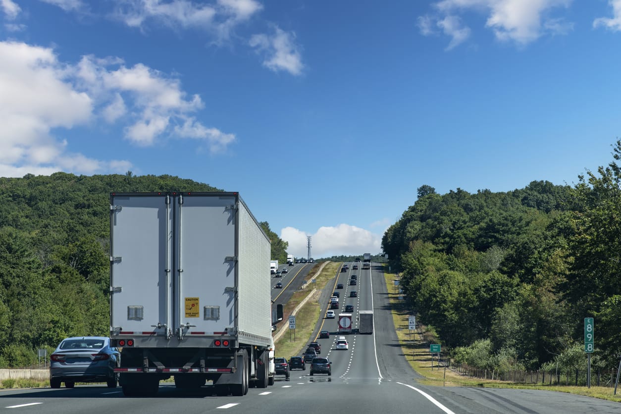
Interstate 95 (I-95) traveling southwest to northeast along the coast
I-84 traveling southwest to northeast in the center of the state
I-91 traveling north to south in the center of the state
I-395 traveling north to south close to the eastern border of the state
The other major highways in Connecticut are the Merritt Parkway and Wilbur Cross Parkway, which together form Connecticut Route 15 (Route 15), traveling from the Hutchinson River Parkway in New York parallel to I-95 before turning north of New Haven and traveling parallel to I-91, finally becoming a surface road in Berlin. I-95 and Route 15 were originally toll roads; they relied on a system of toll plazas at which all traffic stopped and paid fixed tolls. A series of major crashes at these plazas eventually contributed to the decision to remove the tolls in 1988. Other major arteries in the state include U.S. Route 7 (US 7) in the west traveling parallel to the New York state line, Route 8 farther east near the industrial city of Waterbury, and traveling north-south along the Naugatuck River Valley nearly parallel with US 7, and Connecticut Route 9 in the east.
Between New Haven and New York City, I-95 is one of the most congested highways in the United States. Although I-95 has been widened in several spots, some areas are only 3 lanes and this strains traffic capacity, resulting in frequent and lengthy rush hour delays. Frequently, the congestion spills over to clog the parallel Merritt Parkway and even US 1. The state has encouraged traffic reduction schemes, including rail use and ride-sharing.
Connecticut also has a very active bicycling community, with one of the highest rates of bicycle ownership and use in the United States, particularly in New Haven. According to the US Census 2006 American Community Survey, New Haven has the highest percentage of commuters who bicycle to work in any major metropolitan center on the East Coast.
Bradley International Airport is located in Windsor Locks, 15 miles (24 km) north of Hartford. Many residents of central and southern Connecticut also make heavy use of JFK International Airport and Newark International Airport, especially for international travel. Smaller regional air service is provided at Tweed New Haven Regional Airport. Larger civil airports include Danbury Municipal Airport and Waterbury-Oxford Airport in western Connecticut, Hartford–Brainard Airport in central Connecticut, and Groton-New London Airport in eastern Connecticut. Sikorsky Memorial Airport is located in Stratford and mostly services cargo, helicopters, and private aviation.
The Bridgeport & Port Jefferson Ferry travels between Bridgeport, Connecticut, and Port Jefferson, New York by crossing Long Island Sound. Ferry service also operates out of New London to Orient, New York; Fishers Island, New York; and Block Island, Rhode Island, which are popular tourist destinations. Small local services operate the Rocky Hill – Glastonbury Ferry and the Chester–Hadlyme Ferry which cross the Connecticut River.
As rated by our clients and
What do our clients say?
5
Rating
Company
5.0
This is my 4th positive review, don't feel like writing it all again. Everything went swell. Just a great experience.
Derrick Merrill
5.0
I couldn’t be happier with the service I received. The car arrived in perfect condition and even sooner than expected. I worked with Bob Moran and he was the BEST. He explained ,the entire process and was accurate and very helpful. This experience was perfect in every way. Bob Moran made it all happen and the driver was a very professional young man. Perfect!
Donna Kelly Muller
5.0
Contacted Ship-A-Car Inc., one of many. Spoke with Carrie. I knew I was dealing with a broker and since I was a first time shipper I had nothing to fall back on. After a couple of phone calls I decided to go with Ship-A-Car. No problems at all. Transport company and the driver were first class. Picked the car up within two days of my contacting them. Car was delivered two days later on time and on schedule.
Tom P.
4.0
Worked with Larry from Ship a Car a few months ago to ship a vehicle I purchased on the east coast back home to San Diego. Larry was detail-oriented, provided a driver with a fair rate, and picked up the car within the allotted time frame.
The car was delivered earlier than expected which was the joy hiccup; as the vehicle was transferred from a tractor-trailer car hauler to a flatbed trailer from LA to San Diego. In doing so the delivery driver was given an incorrect phone number for contacting me. Fortunately, I was home at 10:30 pm to accept delivery.
The other issue with this unexpected delivery is I didn't have the cash on hand to satisfy the balance due to the driver. However, a call to his supervisor and the payment was made via credit card. Would definitely recommend this coming and would use it again as they're properly insured as well.
C D.
5.0
This was the 1st time that I shipped a car. Ship A Car explained to me the entire shipping process, gave me a reasonable quote and then voila... my car got moved. Everything was just like they explained it to me. Totally Awesome!!! Thanks for everything.
Sam F. Tallahasse, FL
5.0
I called the ship a car and spoke with Paul, he was very helpful and caring. He got the job done in a matter of hours and I was very thankful to him and happy based on the situation I was in. I would recommend ship a car to anyone that needs hauling of any kind and please definitely ask for Paul you won’t regret it!
Dianne Brown
5.0
Had Ship A Car find someone to move a lowboy trailer. Worked with Kristina Virtue to find a power only unit. She was very prompt returning calls and emails. I would recommend this company for anyone needing their service.
Steve M
5.0
First time transporting my Car out of state. My experience from the start was a great experience. My representative Dana was very informative and knowledgeable. Dana made sure I was inform Thur out the transport and even reaching out afterwards to make sure everything went well. I could not have asked for better customer service/ care. I was very happy with the my transport of my Mercedes. The car made it safe on time and not one scratch! The rates was very competitive. I would highly recommend to anyone.
Nicole I.
5.0
Ship A Car has been great. We've used them multiple times. We've shipped my cars back east multiple times for various trade shows, and then we've had them returned. They've been able to meet and exceed every shipment that we've had. So, I'm very pleased with them. Their communication was very precise and reactive. So, they had a quick response time.
Michael of Redmond, WA
5.0
My agent was Harry Burge and the whole transport of my car was smoothly handled. I didn't face any hiccups through out my transportation of my car.I would recommend to anyone as I will be using in all of my future relocation purpose. Thanks Harry and a big cheers to Ship a Car team Inc.
Siddi Avinash
5.0
When I called, I was encouraged by the information Larry provided about your service and best ways to reach him if we had questions. Pricing was fair and in line with what we expected. He called immediately when a driver was available. The transport driver's service had good follow up too and were happy to share information when I called them. The transport driver had good follow up and was easy to reach by cell. He picked up and returned the car to us in a timely fashion with no issues. Overall, it was a positive experience!
Nancy H. Dallas, TX
5.0
I used Ship A Car to ship my car from California to Chicago, I had never shipped anything before so naturally I was a little weiry but I came across Ship A Car after looking at other companies and I thought why not call, Turns out it was the BEST call I made, Very Very nice people, explained everything to me, always took my calls, always answered my calls, my car reached it's destination on time in the same exact shape as when it was picked up... They're the absolute best.
Celia B.
5.0
Very helpful, kept me updated throughout. Shipping went off without a hitch, very timely and easy. Thanks to bob
5 Stars
5.0
Go for this if you need some peace with your car shipment
Shankar K
5.0
I used Ship A Car when I moved across the country. Their service was wonderful. They communicated well with me, they were friendly, and they kept me in the loop on what was going on. The only problem was that the company they ended up hiring for shipping my vehicle was a problem. But when I told them about the problem they were very nice about it, and they handled it very well. I highly recommend them.
Pamela M. Tacoma, WA
5.0
Bob Moran really helped me out and made sure everything went smoothly. He added a very nice personal touch and called up to check in if I had any questions or concerns about where my car was or how much I could put in my car. There prices are great compared to other companies and the service is outstanding.
Alec Walters
5.0
Used Ship a Car Inc. to bring a vehicle from Pennsylvania to Indiana. Raymond the driver was awesome, very professional and kept in communication with me throughout the transport to let me know time of arrival. I was grateful that the shipper car representative kept in touch with me as well, I would definitely recommend them and use them in the future!
Cara H
5.0
Car was shipped professionally, met the time schedule, with overal good experience. Very warm recommendation!
Igal Yaari
5.0
I never had to have a vehicle shipped, but recently experienced a family health emergency and needed to get a vehicle back to NJ. Instead of taking advantage by charging me a lot of money, Danny was extremely sympathetic to my situation and gave me an excellent price for truck to be shippend from Florida to NJ. The vehicle was delivered as promised and there wasn't a scratch on it. If ever I need this type of service again, I no longer have to look any further to find a company because I will return back here.
Vincent H. East Orange, NJ
5.0
Peter Minko provided excellent service, I had talked to peter months before regarding another move that I no longer needed, I had misplaced Ship a Car's info and I was trying to get my sister car shipped from California to North Carolina, everybody's quotes where all over the place and all the other companies stated that nobody was moving that direction or to that state. I had finally accepted a offer from another company that ended up giving me the run around and after awhile would not return my messages. Then out of the blue Peter Minko called with Ship a Car and I accepted his offer, Basically everything came to a HAPPY ENDING and I would use Ship a Car again and nobody else for future car shipping needs. Craig in California
Craig
5.0
Great job by ship a car and their rep. Bob Moran. First time user and I would definitely use them again.
Charlie Wade
5.0
Fantastic company! Janet was especially awesome with perfect and timely communication both via phone and email. The car arrived early and in great condition. Well done!
Ryan H.
5.0
Great Company Great Communicators Did what they said they were going to do !!!! Use them again in a heartbeat !!!!!
L D (CAMOgang)
5.0
Ship A Car was used to facilitate a boat shipment from NJ to Florida. The quote was $1200 and I accepted to get transport within a 2-day window pickup. My ShipaCar rep Paul Sinclair contacted me and stated he had found a driver, but the driver was requesting an additional $50 for pick-up..I agreed to get the boat picked up and remain on schedule. The boat was to be picked up on a Monday or Tuesday and was instead scheduled for a Wednesday pick-up around 1 pm by the driver. Marina owner waited and no one showed or called. Thursday afternoon came and the driver was still a no show and I was contacted by the Marina owner. I contacted my Ship A Car rep and was told he would check with the driver and contact me. No call ever was made back to me by Ship A Car and I ended up contacting the driver myself. He stated he was running late and would be able to pick the boat up first thing Friday morning...I informed the driver I had paid the extra $50 that rep requested from me for the driver to facilitate transport as requested. The driver stated he did not request any $50 increase for shipment as it was posted as $1000 and he had accepted the offer as posted. I contacted Ship A Car, Inc. as the marina owner contacted me stating no one was there Friday morning and had to leave. I received no call back from Ship A Car rep Paul Sinclair as the lady answering the phone told me he would call as soon as he was off the phone with another customer..The driver contacted me around 10:30 am saying he was there and waiting to get the boat. Marina owner arrived and the boat was loaded onto a multi-car vehicle with boat trailer wheels off transport vehicle ramps and being supported by boards under axles and transported. I never received a returned call from Ship A Car rep as I had questions not only of why I was not informed of any shipment delay but also of the driver stating he never asked for the additional $50 amount Paul Sinclair had stated was requested by the driver. Needless to say, Never again will I use this company as they pick a carrier and leave you to deal with any transport issues and possibly lie to get more money from you by blaming transport drivers for up charges. Since I had to constantly intervene and contact the driver myself for answers, I was better off using a self-service company so I could have picked my own carrier and skipped the middle man ShipaCar. Once Ship A Car, Inc. received their $250 deposit I basically was on my own anyway.
Angel C.
5.0
Although this Company did not ship my car. Their response to my needs and great customer services showed me that they actually were looking to help me. They were transparent and did not give me the run around and called me back the same day to tell me they had a carrier to pick up my car. I want to thank them for their due diligence at getting the job done. I will be using them in the future. Thank you Paul!!
Thank You I Will Use You Guys In The Future.
5.0
Ship A Car and their representative Howard Heller was outstanding. Excellent customer service and our vehicle arrived as scheduled and in great condition. The transport driver Raymond McDowell was excellent as well. Very informative and kept us up to date on the arrival which came early. Highly Recommend, this transport company and their representatives.
Craig Knoell
5.0
Needed to ship my car home, after breaking my ankle while on vacation. Called Ship A Car and spoke to Meredith. She was very professional and understood my situation. My car was delivered before I could fly home. I was very please with my service and I can't thank Meredith enough! Would highly recommend!
James B.
5.0
Ship a Car arranged transport of my vehicle from Atlanta GA to Portland OR in Oct 2018. The whole process was carried out exactly according to plan with no surprises and no drama. My agent, Dana Briones, was professional, courteous, helpful, and responsive.
Jay Hughes
5.0
This was my first experience with shipping an automobile cross country, and I must say it was an excellent experience. Bob Moran was very knowledgeable and made me feel very comfortable with the shipping process. We had a great conversation about cars and reminiscing about the good old days. The whole process went great! The car arrived sooner than expected and was in great condition. Bob Moran is a great asset to Ship a Car and I highly recommend them.
Lance R. Danville , IN
5.0
I called up Ship A Car and they were very courteous on the phone. They were understanding that at my age, I'm not quick on the computer and on a whole bunch of things. But I knew what I wanted. They said they would find somebody. They said, "Give us a day." They came back and gave me a basic price. Then they came back and said, "We found somebody who will do it for $50 less. It's enclosed. Everything is perfect. We've had a lot of good feedback with them." So I gave them my credit card and they took their money. I also paid for the extra insurance because it was a specialty car.
Ship A Car reduced the amount that they would get in their pocket by $50 when carrier number one could not pick up the car timely and they had to go to carrier number two, which was the fellow I ended up with. It was perfect. The guys were personable and it was a nice experience. The only thing was that I didn't know when the driver was going to show up. They said, "We'll pick it up Friday or Tuesday or Wednesday or whatever." They couldn't give me a time. So the gentleman called me and said that they were stuck at the car dealership so instead of getting here at 10 in the morning, they were going to arrive at 2:00 or 3:00. He kept me posted along the way telling me when he was going to arrive. So it was a pleasant experience.
When the driver pulled up, he had a Porsche in there, which he pulled out and then put my car in the middle because of the way it was going to be dropped off at the other location. They strapped it all down. He took pictures before it left. Then it was in Nebraska from Long Island in a couple of days. They said it could take anywhere from four to six days, but it only took two and a half days. I was very pleased. My son looked at the car when it arrived and it arrived just the way it left.
Florence of Ronkonkoma, NY
5.0
I would use Ship a Car again in a heartbeat everyone was very professional and courteous.. They kept me up to date on every part of the shipment.. The truck and the people who delivered the car were great.
Sid R.
4.0
Making plans with the company was fast and easy. They did what they said they would do and delivered the car in the same shape it was in upon pickup. Although they promised to call an hour out before delivery, and they did not, they did call upon arriving within blocks of the drop off point.
Larry Burris
5.0
I used Ship A Car Inc to transport my car from California to Wisconsin. After reading a few reviews, yes, the transport truck could be a double decker truck with several cars. Therefore, the driver will ask you to meet him/her at a location near your home...This was my first time shipping a car . How do you find a reputable company? Well, I prayed and read reviews.. I spoke with Bob at Ship A Car, I felt comfortable with the rate and transportation terms. I had no issues. There were no hidden fees, the car was delivered on time and no damages. Thanks Bob for beinging friendly and honest.
Don't Worry, Be Happy
5.0
I transported my 1968 mustang from Texas to Florida with Ship a Car Inc. I was very pleased with their service, professionalism, and timeliness. Their specialist (Maria) worked with both the the shipper and I and made sure we were both contacted for updates throughout. I was very pleased with the price she gave me and the speed that the transactions took place. The driver showed up to the sellers house by the next morning and it was in Florida by the end of the week. I would definitely recommend this company if you needed to ship a car in the future.
Clint D. Umatilla, FL
5.0
I was searching for an Auto Transport company to ship my son's car from Lake Forest, IL to San Diego, CA. He is a Marine and stationed there. From start to finish Ship A Car worked with me to quote a very competitive price. They were very patient as I changed the drop off date a few times because it is very difficult to predict my son's schedule. He was beginning his new MOS with the Marines and he had not received his orders for his shift. I changed the drop off again, from Thursday to Friday when he mentioned that Thursdays he had specific duties and would not be able to leave the base to get his car. It was complicated because for obvious reasons, the delivery truck can't simply drive onto the US Military base. So, my son asked if they could drop the car off at a nearby Target close to the base and provided the address and a date and time that he would be allowed to leave the base. Ship A Car worked with me through all of these logistics. They picked up the car when they agreed and dropped it off as agreed, in perfect condition. My Son, thought this was a better deal than buying a new car at this point. My understanding is that the Marines on the base need some form of transportation. And although my son needed a car, he didn't feel he needed to purchase a brand new car at this time. I can't say enough about the wonderful and patient customer service for Ship A Car. Sam L., the main customer service agent with whom I spoke most frequently, was so awesome! He even called me one evening - after I sent an email changing the drop off logistics - yet again - from his cell phone. He was home having dinner and stopped to deal with my issues! The drivers, Jesus and Saul were extremely professional and courteous as well! I give this company an A+!!!! My son called me and asked me for the contact details of Ship A Car because one of his Marine mates said he would like to do the same thingship his car from his home base; also in IL to California. Thank you again Sam and Ship A Car for all you did for my son, my marine, and our military men and women!
Jacqui R.
5.0
I was looking for a way to send my car from Minnesota to Denver and contacted several transport companies. I was very nervous about sending a car that was one year old and I had taken very good care of with someone/company that I had not ever met and or had any previous experience with. This was the first time that I had ever done something like this so I read all the reviews from each company. I called Ship a Car Inc. and got a real person by the name of Tynesha Jenkins who was a breath of fresh air she was professional at all times took the time to make sure that all my questions and or concerns were addressed. Her follow-up was excellent and I really like that this company has structure in selecting the actual transporter, pick-up and delivery process. I’m a very detail oriented person and I was impressed when the person came to pick my car up. Ivan from IV Auto LLC was dispatched to pick my car up he called an hour ahead of time to let me know when he would be arriving. He was very nice and professional and completed a very detail car inspection report that we both signed off on so there would not be any surprises when the car was received on the other end. My family in Denver received the car in the same condition that it was in before the transport and they echoed the same thing that Ivan is a good man that cares. I will in the future without a doubt call only Ship a Car Inc. to handle my cars and recommend them to my family and friends.
Waymond Johnson
5.0
The Ship A Car rep told me everything that I needed to know. Everything went as well as it could have. However, in-between times, I didn't get any updates. But as far as the information he gave me and what was done, it was spot on. The pickup was in Columbus, Ohio and the drop-off was in Frisco, Texas. The car got there a day earlier than expected, so that was a plus. I was happy about that. The driver was also great. He called and said he was about 40 minutes out. He dropped it off, signed the paperwork and received the money. I will recommend Ship A Car to anybody going that route.
Phillip of Frisco, TX
5.0
Len went above and beyond for my car shipping experience. Great follow up and 100% transparency. 10/10 highly recommend dealing with him. He will find you the best pricing and extravagant service.
Len Rosen Review
5.0
This is a great company to deal with. Bob was awesome and got my cars across the country for a great price . They showed up like I left them . Thank you.
Chris Riester
5.0
My experience with Ship A Car was absolutely fantastic. It was good all across the board, and that's all you can ask for!
Don K. Coral Springs, FL
5.0
Great Service ontime delivery. The driver is more experienced and handled the vehicles great without any issue.
Makireddy
5.0
Riding my motorcycle cross-country from Florida, up to Jasper Canada, and down to California put a hurting on my hands. I was looking to cut out the San Francisco section of our trip and have the bike shipped to Carson City NV. I needed the bike there in two weeks; by the end of September. Two major shippers said they could not get the bike there until October. Then I had the good fortune of connecting with Ship a Car Inc. Steve Goodman handled my request and said they could do it.
I was a bit nervous as Steve took a couple days to arrange transport and call me. But he came through and got the bike transported quicker than I would have expected. Since we were already in San Francisco, I called the shop in Eureka CA where I had left the bike for pick-up. As Steve had said, the bike was transported in an enclosed truck. The shop told me the driver was very professional and took a long time to make sure my bike was loaded and secured properly. I then called the shop in Carson City where the bike was to be delivered. They told me the bike was already there, that the driver had taken great care with my bike, and that he seemed very professional.
This was a very difficult time-frame to deal with. This was not a pre-scheduled transportation issue. It was a last-minute decision on my part. The location of the pick-up shop in Eureka CA was only an every two-week area for the two other shippers I had tried. Steve Goodman and Ship a Car Inc came through. They saved our vacation and I am grateful, extremely grateful for the professionalism displayed. I would use their service again… in a heartbeat.
Ship a Car Inc. is the best motorcycle shipping company I have had the pleasure of encountering. This is the second time they have shipped my bike. I have had experience with other shippers and, in my experience, Ship a Car Inc. sets the standard for quality service.
This time I had my bike shipped from Santa Fe NM to Florida. Joseph Gorfien was my facilitator. He arranged to have the bike picked up within a couple of days. Considering the shop at which I had left it was closed for a day, this was the first possible opportunity to ship it. Amazing! Joseph thought it might take about six days to deliver the bike to Florida, but it got here in three. Amazing! The bike has a custom paint job and custom parts. There was not one scratch on the bike and everything was in perfect order.
These folks have not only demonstrated extreme competency in making what could have been a couple of difficult situations totally stress-free, they all seem to have a great sense of humor. I love these folks!
Thank you for a couple of wonderful experiences, Ship a Car. I highly recommend their service. In the future, I won’t use anyone else.
David Grant
5.0
I had my car shipped from De to FL with no problem. The driver was really nice, friendly and arrived on time. As soon as I landed my car was ready for me to pick up. Anytime I had a question it was easy to get in contact with them. I would definitely recommend them to anyone.
Tykeah
5.0
It was a great experience. I’d do it again
K. of Oh, OH
5.0
I was disappointed to see some very low ratings on Yelp about this company. I spoke with Steve and a guy named Mike transported my 2 cars from California to New Orleans. My driver's name was Mike and he called me every day to let me know where he was in his transport. The cars arrived in pristine condition and very timely. I guess everyone's experience is different...but I got all-star treatment.
Michelle H.
5.0
I was extremely nervous about having my car shipped, looked for a reputable company for days, I was really to the point I was ready to give up! Came across Ship A Car and decided to call...Best call I ever made, they explained everything from day one, answered all my questions, & calls... Very Very professional, my car arrived in the exact same shape as when it was picked up....I would definitely recommend Ship A Car... Trust me ! Best call you'll ever make.
Celia B. Algonquin, IL
5.0
You guys are unbelievable! You made this so easy...... This was our first time transporting a car and after vetting-out all the unscrupulous brokers we found Ship A Car. You provided a covered transport in two days... My mechanic says that is unheard of... In all the years he has transported vehicles the shortest time for pick-up was 1 week... The assigned transport driver kept us informed of the progress and delivered the vehicle from Santa Rosa CA to Indio CA in 1 day!
Chuck Clifford
5.0
I can not speak more highly of the assistance Joseph G. provided me throughout this process to date. When I first worked with Joseph on this shipment, he told me that if I needed anything during the shipment stage, to let him know. And he was true to his words! When I had to change the person who was going to drop my car off at the shipping port, he immediately contacted Matson to make that change. On the day of the drop off, an issue came up regarding the acceptance of my vehicle at the port, so I called Joseph to see if he could assist. He immediately attempted to get in touch with me to see how he could assist. When I didn't pick up his call, he right away contacted the person I had told him was going to drop the car off at Matson to find out the problem. I then called Joe back, and discussed the problem with him. After a discussion, he gave me pointers to resolve the issue, and requested that I contact him about any subsequent next steps that he could assist with to ensure the car was accepted on that day, which was actually the final day to have my auto on the next ship. I am greatly impressed with the care and concern that Joseph displayed with my situation. He had a definite "can do" attitude, and was ready to jump in head first in order to help me in any way he could to make sure the shipment was a success. To add importance is that I am attempting to have my car shipped from Honolulu to California while I am trying to manage this as I currently am located in Dallas. Having Joseph as my wing man and a concerned and very responsive primary contact point is invaluable, since this is such a long distance transaction for me. If Joseph is a true representative of Ship A Car and the character of their associates, Ship A Car and Joseph deserve 5 Stars and beyond. Needless to say, I am a very satisfied customer.
Rod S.
5.0
Joseph Gorfien was a pleasure to work with. He was very responsive each step of the shipment of my four seater golf car from picking it up on Marco Island to delivery in Roswell Ga. - picked up on the 4th and delivered on the 5th just as quoted which was a reasonable price. Thank you Joseph!
Larry Roswell
5.0
Thank you Meredith for a personable and professional service experience. I would recommend you to any of my family and friends in future need of Ship A Car. You made the automobile part of my relocation stress free.
V S. Lodi, NJ
5.0
We are military and we had to ship our 2nd vehicle from JBPH-Hickman, HI to Seattle, Wa. Using Ship-A-Car Inc was the best decision we could have made. They weren't the cheapest option, but you get what you pay for. Bob walked us through the entire process and he was constantly keeping us updated. We shipped our SUV 30 May 17, left Hawaii the very next day. Coming back stateside, we received some grave news. We had a death in the family. We now had to go on emergency leave, but our SUV was on its way to our new duty station. We had to leave right away and didn't know if we would be back in time for the delivery. Bob was an angel! He coordinated everything from our SUV being pick up at Seattle, Wa to the delivery being held without incurring extra charges on our part (Thank you Aaron!). With everything that was going on, it was refreshing for a change to have someone else watching out for us. He made the entire process easy and painless. We couldn't thank him enough. If we could give him 10 stars, we would. If we had to ship a vehicle again, I know exactly where to go, Ship-A-car Inc.
Asia Gonzales
5.0
The entire process was so smooth and professionally handled. From Meredith our transport agent to Justin our transport driver it was a seamless process. We needed our car shipped from the west coast to our new home nearly 2200 miles away. We were in nearly constant communication with Meredith who provided updates promptly. When we had a hiccup on our end, our driver, Justin worked with us with no problem. Our car was delivered on the date and time promised and in undamaged condition. This was such a positive experience for us.
Glenn F.
5.0
STEVE, THE BEST REPRESENTATIVE!!!
In a spite of a very difficult route to pick up and deliver my 2016 Mercedes, Steve was diligent and transported my car with no problems from pick up to delivery in Law Cruces, NM
I WOULD TOTALLY RECOMMEND THIS COMPANY.
THANK YOU STEVE, for your patient and compromise!!
Michael W.
5.0
Bob was wonderful to work with. He researched the specific needs I had for moving my car and found the perfect transporters to handle it. They're the best!
Rand Z
5.0
thank you for the hipping the m/c ... my name is tom wentz .Allentown pa ...your rep who I spoke with did a very very good job and followed up on the shipment ..ex job iam going to have a few of my dear friends contact him if they need m/c shipped anywhere ...also the gentleman who got it here also did a very good job thank you for the ex work guys ....tom wentz ,,,, thanks again ,
Tom W. Allentown, PA
5.0
I needed to move my 67 Mustang to Northeast Georgia from Sarasota before Hurricane Irma. Meredith, at Ship a Car, was great at finding me an enclosed trailer to bring the car up here. It arrived in perfect condition.
William Dellert
5.0
BEWARE of Ship a Car. Check better business Bureau. Their rating is "F" for FAILURE. They donot respond to any Claims or complaints. DAMAGED ROOF AND DENIED ANY RESPONSIBILITY. DO NOT USE THEM!!!
Beth Stein
5.0
I would like to thank Joseph and the owner of the company for all their hard work. I would specifically like to thank Joseph for putting up with me and the mess that was created by a driver who was supposed to pick up my car but they decided to cancel literally with less than 24-hour notice when it was time to ship my car. I got really stressed because I needed it to get done since I am moving. However, Joseph really handle the situation with professionalism and made sure my car got shipped the next day, and even got me a better deal because my car is getting to Texas sooner than it was originally going to get there with the first driver. The driver who picked up my car the next day was extremely professional and communicated with me the entire time. I would 100 % recommend this company to anyone and ask for Jospeh because he is the best!!!!
Victoria H.
5.0
ship a car was fantastic they were on time with pick and delivery date. actually earlier then expected. The driver from Spalinda Transport Paul with his cute Russian accent was very pleasant and on point with is estimation time of arrival. 100% guarantee satisfied customer. I will differently use and recommend Ship a Car to a friend in need.
Gwen S. Brockton, MA
5.0
Ship A Car had good communication and everything they said that was gonna happen, happened. From the time we started communicating to the drop-off, it was seamless. I was pleased.
Shurla of Mansfield, TX
5.0
We worked with Bob and he was fantastic. He always answered my call, explained the process thoroughly and kept me up to date during the process. I'll admit I was nervous, but definitely selected the right company to work with. Would definitely recommend.
Katherine M.
5.0
Excellent customer service from Dana Briones from inquiry until the successful drop off of my new car from Pennsylvania to Los Angeles, CA. She was professional, knowledgeable, friendly, reassuring and made herself available when I called to check on the location of my car after 4 days. I was also provided with the driver's full name and cell phone number. I most appreciate that Dana was honest about the estimated transport pick up and delivery time frame. The driver Alex was the absolute best. He called me and the car dealership the morning he picked up my new car. We spoke about 4 days later and he told me his expected delivery day. On that day, he texted me to let me know the time based on his GPS. He arrived earlier than expected. This was my first time purchasing a car from the internet, from another state and using an auto transportation company. I did have anxiety in the beginning. However, EVERYTHING went smooth and I have nothing but great things to say about Dana and Ship a Car Inc.